The fishermans advantage.. North Carolina fishing spots for GPS
North Carolina Fishing Spots for Marine GPS. Our North Carolina fishing spots files import to the top marine GPS brands and models. Use our spots with Garmin, Lowrance, Simrad, Raymarine hybrind/touch, Furuno TZ touch models and Humminbird GPS models that accept an SD Card.
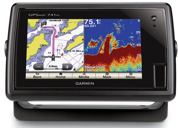
Quick facts – Did you know? Over 70 percent of our customers are users of Garmin GPS models with the most popular being the Garmin 741XS. Second in line is Simrad GPS.
Load up your spots, it’s easy! We’ve made it super easy for users of all skill levels. We provide simple, easy to use ‘copy and paste’ files. These files are emailed to you the same day of any purchase to get you on the water right away!
Why we’re number one! For our customers and potential customers, it should be noted that we have been providing Guide level Fishing Spots Maps for a variety of GPS models for over 14 years in most coastal States.
Our included GPS files, waypoints and fishing spots work with the following top name brands that accept an SD card. (All brands listed are (c) or TM.)
- Garmin
- Simrad
- Lowrance
- Raymarine touch/hybrid only
- Humminbird
- Furuno TZ touch only
Top reasons fishermen choose our product
- No more entering GPS Coordinates Manually
- Copy and Paste files are included and emailed for all GPS Brands above
- Pre-loaded SD cards are always available, simply select the SD card option during your checkout
- Confirmed local Fishing Spots from our local experts and Guide network who fish for a living
- Files included for iPhone or Android Mobile use with Google Earth, Navionics (TM) or other GPS apps
- Top Fishing Spots to Ledges, Wrecks, Reefs, Live Bottom, Breaks, Rips and more.
- Reasonably Priced for most any Offshore Fisherman
- All our fishing spots products are rated 4.7 – 5.0 Stars by our Customers!
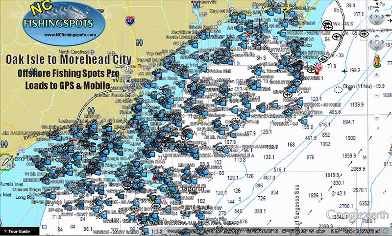
North Carolina Offshore fishing spots for Google Earth on computers and mobile devices! Use the Navionics boating app to download highly detailed Offshore Nautical fishing charts for any area in the USA. Also, use the free Google Earth app for mobile or computers to see comments, spots names and more.. All the files for the above mentioned apps are included, and emailed to our users the same day of purchase.
Note: These files are included with any purchased fishing area and works with IOS- iPhone, Android and computers using the free Google Earth App or as mentioned, highly detailed maps are found within the Navionics boating app full version! Start enjoying fishing, know your spots and learn the apps for the best product and fishing experience .
Shoppers Note: Always be sure you see our BLUE OVAL LOGO on the header when shopping for Guide Level fishing maps online. This logo is found on top of all our websites in (9) Coastal States. We are the original and only company online working directly with fishing Guides to bring you a superior product. We’ve been in the fishing spots business for over 10 years online and on land.
- Use with the free Google Earth App and the Navionics (TM) app found on the iPhone Marketplace or Android Play store
- Any purchased Fishing spots allow reading of comments on Mobile and computer using Google Earth for trip planning.
- View Offshore Depth Contours and other chart options right from your Computer or Mobile Phone device
- See where breaks and rips are found, on an around contours and shallower humps in offshore waters near your fishing spots
GPS Fishing Maps Co owns certain copyrights and trademarks to data found within the product files and on this website. For more information with a speedy reply to your questions, please use our super fast contact form found here


