How it works and what comes with our fishing spots
Using North Carolina Fishing Maps for your GPS, Phone and Tablet – See how our fishing spots work and what’s included below. We offer customers over 16 years experience and bring anglers the best GPS fishing spots available, for beginning or avid fishermen. Our GPS spots will optimize your fishing time with accurate GPS coordinates to top fishing spots for speckled trout, redfish, striper, Tuna, Mahi, King Mackerel, Blues, Snapper, Grouper and more!


1. North Carolina Fishing Spots for your boats GPS – Load it yourself for immediate use! Load our GPS files yourself using our included DIY GPS files, a blank SD card 32gb or less and a windows computer (windows only. Note the DIY GPS SD Card files are recommended for advanced windows users only. If your GPS accepts an SD card, the days of typing in GPS coordinates is over with! We email you copy and paste GPS files with any purchase, that loads our spots to a blank SD card, then imports to your GPS using a windows computer. Once loaded into your GPS from the SD Card, all the GPS coordinates and their names will show on your GPS map screen and in your waypoints list on your GPS.
 PRELOADED SD CARDS FOR GPS! No need trying to load your own card here.. Our Preloaded fishing spots GPS SD cards are always available for the following GPS models. Use with Garmin©, Lowrance,© Raymarine Hybrid© , Humminbird©, Simrad© and the new Furuno TZ Touch© GPS brands that accept a micro SD Card.
HOW TO GET A PRELOADED SD CARD? Simply select the SD card option during checkout.. Our GPS cards are custom loaded to your GPS brand, tested in house, then quickly shipped to your front door with tracking and insurance. Note – You will always receive all the mobile, GPS files and other files for your purchased spots via email, even when you choose the SD card option. These emails are sent the same day of purchase.

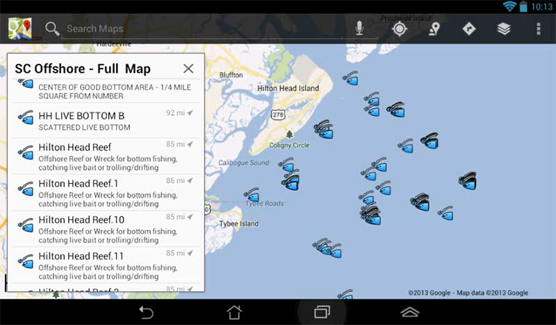
2. Use your mobile device as a fishing GPS or trip planner with our North Carolina Google Earth, Navionics (c) and other apps for your iPhone or Android phone and tablet. This file opens on your computer and mobile device using the free Google Earth app and a couple others we reveal in the instructions. You can use any app that accepts a Google Earth file. Use a dash mounted marine GPS for the most accurate results.. See a sample of what it looks like when loaded (Actual views will vary greatly depending on your device version age, signal strength, available memory and battery status Remember, samples are only samples and do not show all spots)
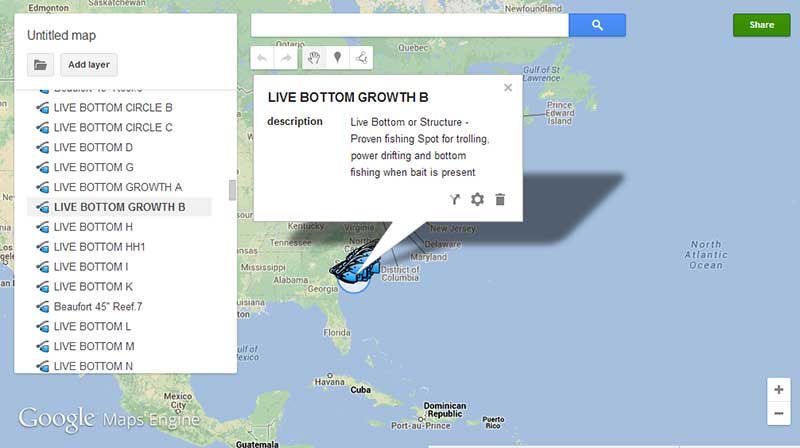
3. View comments on your North Carolina fishing spots – Most of our fishing spots have comments about what type of bottom, structure or other info about the fishing spot. Much of this info transfers to your GPS comment section (depending on how your GPS accepts comments) and comments are shown with a simple click using Google Earth and Google Maps on many devices. See a Sample of Fishing Spots Comments
4. Label Matched, printable North Carolina GPS Fishing Coordinates in Lat/Long document for viewing or printing the Lat/Long coordinates. The GPS coordinates are name matched with all other files in your purchase and can be entered into any GPS in the world. Print this and take it with you on the boat, or save the file for safe-keeping in case you ever need it for reference or you find the need for using the lat/long coordinates for your purchased area. See a GPS coordinates list sample (Samples may or may not show local fishing spots)
5. Advanced Fishing and Rigging Tutorials upon request, for nearshore and offshore fishing from North Carolina and the East coast in general. Our guides and commercial fishermen have come together to compile excellent, detailed tutorials for those who need them to include tips on rigging for offshore bottom fishing, rigging and trolling on the East Coast and Coastal North Carolina offshore fishing.
6. All the above mentioned files are included with any purchase from this website. The files are conveniently emailed the same day of purchase to get you on the water immediately. Note: For you convenience, these files are sent in a ZIP file for easy handling. We suggest un-zipping/Extracting the Files to an easy to find location, such as the desktop on your computer. Mobile files open very simply from your email into your chosen GPS or Google Earth app.
Questions? Email anytime using our contact form found here